Flood Control 2.0 and Sedimatch


Flood Control 2.0 is an innovative, award-winning program that integrates cost-saving flood protection infrastructure with environmental benefits along the San Francisco Bay Shoreline.
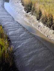
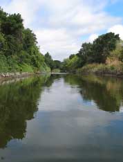
The strategy involves two complementary approaches - sediment redistribution and channel redesign - resulting in several beneficial outcomes: the transformation of sediment trapped in local flood control channels into a valued resource, restoration of wetland habitat and improvements to both water quality and shoreline resilience.
From 2012 - 2016 an interdisciplinary team of partners linking regional science expertise with flood control agencies worked together to work out a vision for the program and help guide it’s implementation at three creek mouths:
Along the way a long-term management strategy was developed to integrate ecological functions and flood protection. Additionally, the team collected and compiled data on coarse sediment and historical stream characteristics at a region-wide scale, analyzed costs and benefits of designing multi-benefit projects in the flood control zone, and published a regulatory analysis and guidance document to help flood control and resource managers navigate through the design and permit process.
A suite of tools was also compiled and published on the official Flood Control 2.0 website. In addition to reviewing the results of the implementation projects, users can download and use broader tools to design their own multi-benefit flood protection projects in the region or beyond.
Among these tools is SediMatch, an online database designed to ensure that entrapped sediment becomes a resource available to restoration sites. SediMatch is a related effort led by the SFBJV, BCDC, Bay Area Flood Protection Agencies Association, The Bay Planning Coalition and others seeking to bring together the wetland restoration and dredging/sediment supply communities for the shared goals of creating healthy wetland habitats and maximizing beneficial reuse of sediment.
In these forums for discussion, challenges and potential solutions for increasing reuse of dredged and excavated sediment at habitat restoration sites are explored. This program aligns with the Long-Term Management Strategy for Placement of Dredged Material in the San Francisco Bay Region (LTMS) and seeks to implement the recommendations found in the updated Baylands Goals report regarding using dredged and upland sediment to accelerate the rate and scale of wetland restoration through sediment supply augmentation.
The SFBJV began tracking the sediment needs of restoration projects in 2011 and hosted the first match-making meeting between restoration project managers and dredgers at BCDC in 2013. As a result of that meeting, several “matches” have been made to deliver dredge material for beneficial re-use at restoration sites.
You can learn more about the Flood Control 2.0 process, results, and tools, by listening to our podcasts on the SFBJV website or at SFEI. Here you will find a thorough introduction to the concepts behind the project with information about the critical role sediment plays in a healthy watershed, details on each of the three creek projects with lessons learned from our visioning exercises and two additional programs about the regulatory processes behind designing such projects, along with the SediMatch tool.
You’ll also find more information about Flood Control 2.0 on SFEP’s website where Action 12 from the Estuary Blueprint (updated CCMP) is completed by the release of the online toolkit.
This project was funded by a grant from the US EPA San Francisco Bay Water Quality Improvement Fund. Project partners include the San Francisco Estuary Partnership, San Francisco Estuary Institute, San Francisco Bay Joint Venture, and the Bay Conservation and Development Commission.
