Project Maps
Active Projects
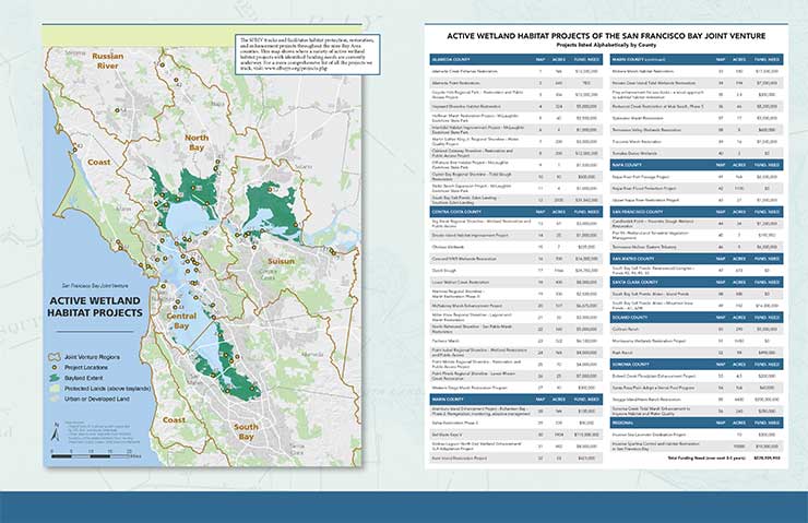
The map and table below represents a subset of SFBJV active projects with current funding needs, last updated in 2020.
Click on map below for PDF
San Francisco Baylands Maps: Past, Present & Future
Click on maps for larger versions

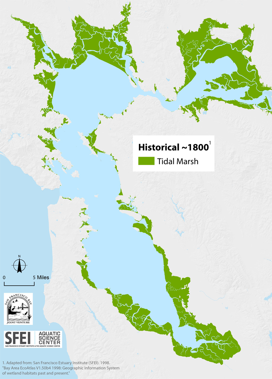
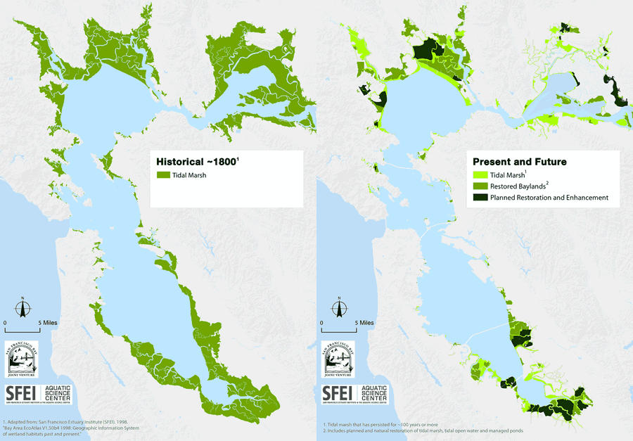
Past: This map shows the historical extent of tidal marsh around San Francisco Bay, circa 1850 before most modern development.

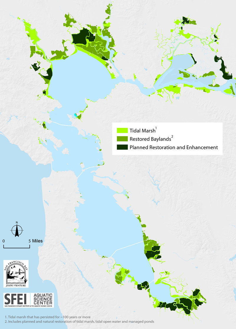
Present and Future: This map shows the current extent of tidal marsh that has persisted around the Bay for 100 years or more (light green), restored baylands (green), and restoration projects that are either on their way to forming tidal marsh, or that enhance non-tidal habitats (darkest green).
For questions about these maps please contact Micha Salomon.
San Francisco Baylands: Past, Present & Future Animated Map

San Francisco Baylands Acreages: Past, Present & Future
| SAN FRANCISCO BAY COUNTIES |
ACRES OF Historic Tidal Bayland CIRCA 18501 |
ACRES OF Protection, Restoration, and Enhancement Projects COMPLETED2 |
ACRES OF Protection, Restoration, and Enhancement Projects IN PLANNING OR CONSTRUCTION3 |
| Alameda | 30,800 | 13,649 | 4,992 |
| Contra Costa | 12,100 | 5,004 | 4,167 |
| Marin | 13,600 | 5,208 | 3,236 |
| Napa | 12,000 | 13,577 | 1,935 |
| San Francisco | 900 | 62 | 17 |
| San Mateo | 19,900 | 7,099 | 670 |
| Santa Clara | 14,800 | 9,755 | 4,144 |
| Solano | 62,900 | 11,256 | 2,108 |
| Sonoma | 24,700 | 11,891 | 8,123 |
| TOTALS | 191,700 | 77,501 | 29,392 |
- From San Francisco Estuary Institute (SFEI), 1998. Bay Area EcoAtlas V1.50b4 1998: Geographic Information System of Wetland Habitats Past and Present (www.sfei.org/content/ecoatlas-version-150b4-1998).
- Note that acreages are counted at different stages of a project, so some acres are counted multiple times to represent each distinct action that has taken place. For example, a property that was acquired and later restored would be counted once as a “Protection” project and again as a “Restoration” project.
- These acreages represent wetland projects tracked by the San Francisco Bay Joint Venture (www.SFBAYJV.org). These are the types of projects likely to be eligible for Restoration Authority (RA) funds and do not include habitat types that would not qualify.
For questions about the table above or SFBJV projects in general please contact Sandra Scoggin.
